
Verified Libertyville ZIP Coverage
Only 60048 was confirmed as a current Libertyville postal code in the official sources reviewed. The proof is the USPS facility listing for the Libertyville Post Office. That finding is narrower than many informal ZIP lists, and it matters. Historical postal sorting references mention 60060 and 60092, but they do not establish that either code now serves the incorporated village. A careful Libertyville ZIP code directory keeps those candidates unresolved until a live postal result or current parcel match supports them.
| ZIP | Libertyville relationship | Postal facility | Verification note |
|---|---|---|---|
| 60048 | Confirmed Libertyville postal city context; the mailing area may extend beyond village limits | Libertyville Post Office, 1520 Artaius Parkway | Confirmed by the official USPS facility page |
| 60060 | Current Libertyville coverage not established | Not located in the reviewed official sources | Historical sorting references alone are insufficient |
| 60092 | Current Libertyville coverage not established | Not located in the reviewed official sources | Requires a live USPS or parcel-level check |
The table does not claim that every 60048 address lies within the Village of Libertyville. ZIPs route mail; municipal lines assign local jurisdiction. The township and county add still more boundaries. Treat 60048 as the confirmed postal anchor, then test the exact property against the right geographic layer.
USPS Proof for Libertyville ZIPs
The USPS ZIP Code Lookup offers three distinct searches. “By Address” uses a street address plus city, state, and code, with fields for a company and unit when needed. “By City and State” tests a city label. “Cities by ZIP” reverses the question. USPS also warns that a result does not confirm a person, company, or address. It checks postal data, not residence.
The official Libertyville Post Office listing supplies the firm source for 60048. The captured source is shown below.
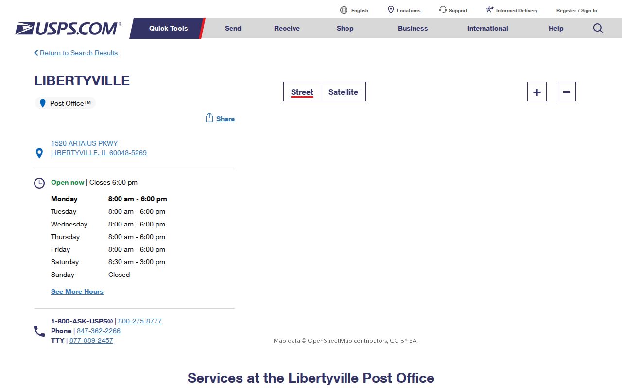
This facility record proves the postal office and its address. It does not draw the code boundary or identify people served by it. For that, pair the postal check with County GIS.
Note: A facility address confirms a postal anchor, not the full limits of the mailing area.
Lake County ZIP Polygon Layer
Lake County publishes a ZIP polygon service with a five-character ZIP field, geometry, query tools, statistics, and pagination. A polygon can show where a parcel point falls within the county’s mapped postal geography. It should be compared with the parcel, address-point, township, and municipal boundary layers because none of those shapes is interchangeable.
The manifest image below captures the public service description rather than a hand-drawn boundary.
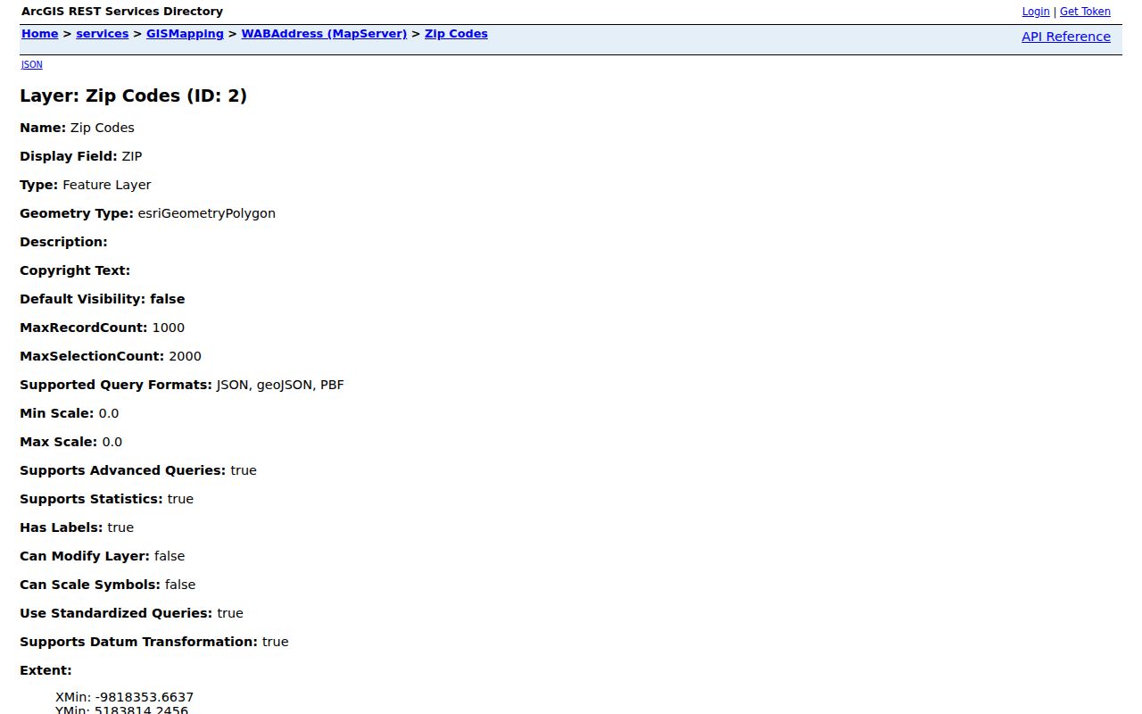
The service confirms that ZIP is a mapped polygon field. Its service-date text was not exposed in the research, so record the access date when using it and avoid treating the layer as a permanent postal boundary.
Search Libertyville Residents by ZIP
A ZIP-wide search is most useful for narrowing parcels, not producing a complete resident roll. The Lake County Assessor accepts a code with address, PIN, owner, or billing-name terms. The GIS layer then tests the point against mapped geography. Once the result narrows to a road, the Libertyville street directory explains the more precise address workflow.
- Verify the city and code through USPS. Save the exact formatted result and its date.
- Place the address point in the County ZIP polygon, then compare the village and township layers.
- Search the Assessor by ZIP and a second field, such as street or PIN, to reduce false matches.
- Read the result’s role label. An owner or billing name is not automatic proof of current occupancy.
- Move to parcel, deed, or other official records only when the question requires that next step.
This order keeps postal formatting, mapped location, and recorded names separate. It also avoids a common error: counting all tax results under one postal code as village residents.
Libertyville ZIP Search Fields
The Lake County real-property search exposes the fields below. It displayed a maintenance notice during research and warns against data mining or extraction. Search a small, defined set and retain the tax year. This is an assessment source, not a postal directory.
| Field label | Input | Required | Use and format |
|---|---|---|---|
| Parcel ID | Number | No | May be entered without dashes |
| Owner or Billing Name | Name | No | Owner uses last name, first name; roles remain distinct |
| Address No, Street, Unit | Address | No | Street search omits direction in the stated instructions |
| Zip Code | Five digits | No | Combine with a narrower field |
| Filter, Options, Sort | Controls | No | Refine display, tax year, order, and result count |
A result may show situs, taxpayer, mailing address, neighborhood, legal description, municipality, township, and many taxing districts. “Situs” means the physical parcel address. The mailing address may belong to a different city or an entity, so preserve the field label instead of changing it to “resident.”
Libertyville ZIP and Village Limits
The incorporated Village of Libertyville is Census geography with FIPS code 1743250. Its 2020 population was 20,579, the July 2025 estimate was 20,701, and its land area is 8.81 square miles. Those figures describe the village. They do not count every address with Libertyville as its postal city. A parcel can instead lie in Libertyville Township or an unincorporated part of Lake County.
The 2023 Libertyville City Township Map supplies municipal, township, parcel, district, park, and building context. Use it beside the County ZIP polygon and USPS result. This three-source check answers three different questions: where mail is routed, where the parcel sits, and which government has jurisdiction.
- ZIP code
- A five-digit postal routing area, not a city boundary.
- ZIP+4
- An added four-digit delivery segment within a ZIP, often tied to a block, building, or delivery group.
- PO-box ZIP
- A code used for post-office-box delivery rather than a normal street area.
- Unique ZIP
- A code assigned to one high-volume organization; none was confirmed for Libertyville.
- Carrier route
- A postal delivery path that may cross other civic boundaries.
Libertyville's Dual-Address Record
A local address change can make a sound ZIP code directory search look wrong. Lake County adopted a revised address ordinance in July 2019 and standardized single addresses for about 3,000 unincorporated properties. The published FAQ counts 3,160 affected properties; 2,712, or 86 percent, kept their primary address. Public-safety and postal coordination led toward NG911 implementation on July 1, 2020.
Libertyville-area examples include Saint Mary’s Road, Sunnyview Road and Bell Lane, Terre Fair, and Woodfield Lane. These are roads associated with the County project, not a list of streets inside the village. If an older deed, directory, or family record uses another number, retain both versions with their dates. Check the County address point’s Current, Pending, or Retired status, then consult plats or a targeted GIS request.
Insider tip. A former address is a dated research key, not an error to erase from the record trail.
District Clues Inside 60048
One Libertyville parcel may carry a township, municipality, road and bridge district, school districts, park district, fire district, library district, sanitary district, mosquito district, water-agency field, and special assessment or tax-increment designation. The County tax panel exposes that civic “constellation.” It can route a request to the right office when postal city alone is unclear.
These fields do not create sub-ZIP resident lists. They explain why two nearby 60048 parcels may answer to different agencies or appear in different files. Use the parcel identification number, or PIN, to hold the records together. A PIN is the County’s parcel key; it is more stable for land research than a person’s name or a mailing label.
Note: School and service-district fields are routing clues, not proof that a person uses or belongs to an institution.
Keep Libertyville ZIP Claims Current
Postal and county interfaces change. Research found a new Lake County Maps Online platform announced in January 2026 and a rebuilt Tax Parcel Viewer announced in March 2026. The Assessor also displayed a current-data date during inspection. A saved result should therefore include the query, access date, source URL, and the fields that matched.
For 60060 or 60092, absence of proof is not proof of absence. Mark either as unconfirmed, then repeat the live USPS city/state query and test a specific parcel in County GIS. That approach keeps the Libertyville ZIP code directory useful without overstating a historical sorting note. The final claim should be as narrow as the source: postal match, mapped polygon, parcel jurisdiction, or village geography.
Libertyville ZIP Voter Limits
The Lake County Voter Power page uses first name, last name, house number, ZIP, and date of birth for an individual check. It is not a ZIP code directory of registered people. Separate Illinois voter-file rules restrict electronic file access and permitted uses, so a postal code should not be used to assemble or publish a general resident list.
When the aim is to verify one known person, supply the exact fields the official tool requests. When the aim is geographic, stay with USPS, GIS, the Assessor, and municipal boundaries. This split is useful in Libertyville because a postal city, township, parcel jurisdiction, and incorporated village can overlap without matching. It also keeps sensitive voter data out of a broad search.
A negative result remains narrow. It may reflect an input mismatch, restricted data, a recent move, or a person who is not registered. It does not prove that nobody lives at the address. Record the query and date, then report only what the official response actually states.